
Redistricting: Your School District
Who has to redraw their boundaries because of the Census?
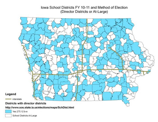
Districts with director districts under §275.12 b-e
Each school district with director districts must file with the Secretary of State, County Auditor(s), and AEA the following, even if the school board does not make any changes to the method of election and/or director district boundaries:
-
School district worksheet prescribed by the Secretary of State’s Office
-
Director district maps
-
Certification of the population of each director district
-
Resolution adopting director district boundaries
If director districts are not changed, your CSD will have to prove analytically that "no change" is warranted; the district still needs to go through the redistricting process.
How is redistricting done for school districts?
Following are the step by step requirements school districts must meet in redistricting director districts. After the code explanation a hypothetical example is provided to see the software and understand the decisions to be made.
-
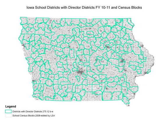
Follow census block boundaries [§275.23A(1)(a)]
-
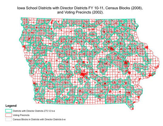
Follow precinct boundaries [§275.23A(1)(a)]
-
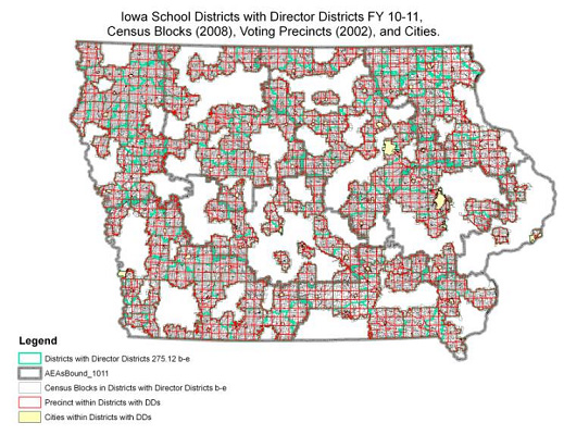
Cannot divide cities: A city cannot be divided into director districts unless the population of the portion of the city that is within the school district is greater than the ideal district population. If so, the city must be divided into the smallest number of districts as possible. [§275.23A(1)(e)]
-
Meet ideal director district population standard: District populations must be as close as possible to the ideal population of a district. To find the ideal population, divide the total population of the school district by the number director districts. [§275.23A(1)(b)]
An Example of Our Redistricting Service
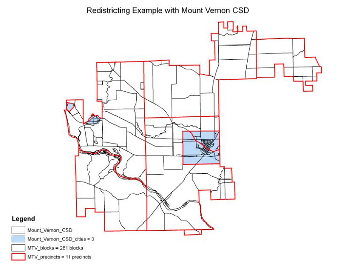
Jim has a fondness for Mount Vernon as he attended Cornell College. So for this scenario - which is completely hypothetical - Mount Vernon has been chosen. The data used are all the correct type of data, though they are outdated.
Readers should note the irregular shape of the Mount Vernon school district. School districts due to their organic growth and definition of boundaries are irregular compared to counties or legislative districts; hence, it is difficult to argue compactness when director districts (DDs) are drawn.
The most DDs a school district can have is seven, and we'll use that number in this example.
Further note the map's legend. There are four relevant layers - the school district, cities, precincts, and census blocks - with 296 polygons in total to consider.
With seven director districts in the example that means the ideal director district size would be 794. Therefore, the city of Mount Vernon must be divided into director districts.
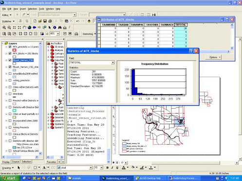
Mapping Strategies uses ESRI products and this is a districting module extension running with ArcGIS.
The screenshot captures three other very important aspects:
- See the summary statics, which are required and necessary for calculation;
- Another window shows the attribute database associated with the map;
- The previous described features and the interface demonstrate the ability to recalculate on the fly and consider different scenarios.
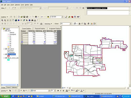
Geographic Information Systems (GIS) allow for:
- Simultaneous consideration of all redistricting factors
- Iterative analysis allowing for strategic scenarios
- In this scenario consideration is being given to dividing the school district population by mixing rural and urban areas of keeping them separate.
- Statistics for plan justification deviation and percentage deviation